Solar Drone Site Assesment
Site Assessment
High resolution imagery of remote project sites.
About.
Making decisions quickly is never easy, and making well-informed decisions quickly can be downright impossible. In the past, assessments used to mean sending an engineering team to your site to get gather details that simply aren't available via Google Earth. But sending a full team costs time - and a lot of money.
For prospective site development, PXYZ's drone-derived orthomosaic imagery will provide you relevant, timely and cost-effective alternatives to on-site visits. A drone team can shoot up to 5000 acres per day, giving you access to huge areas of land in no time flat.
Details.
Avoid hidden obstacles and unexpected costs at your prospective project sites, getting the detailed imagery you need to quickly evaluate potential impact while improving the efficiency of team field deployments using our Air-2-Ground platform.
Rapid Site Assessments
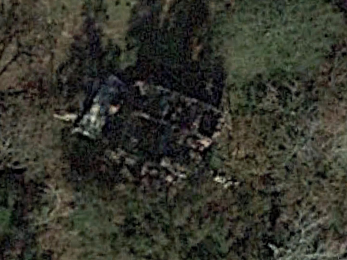
Google Earth is a great tool for overall site evaluation, but this site shot - taken from the same location as the following image - generates as many questions as it does answers, often requiring onsite inspection and boots on the ground.
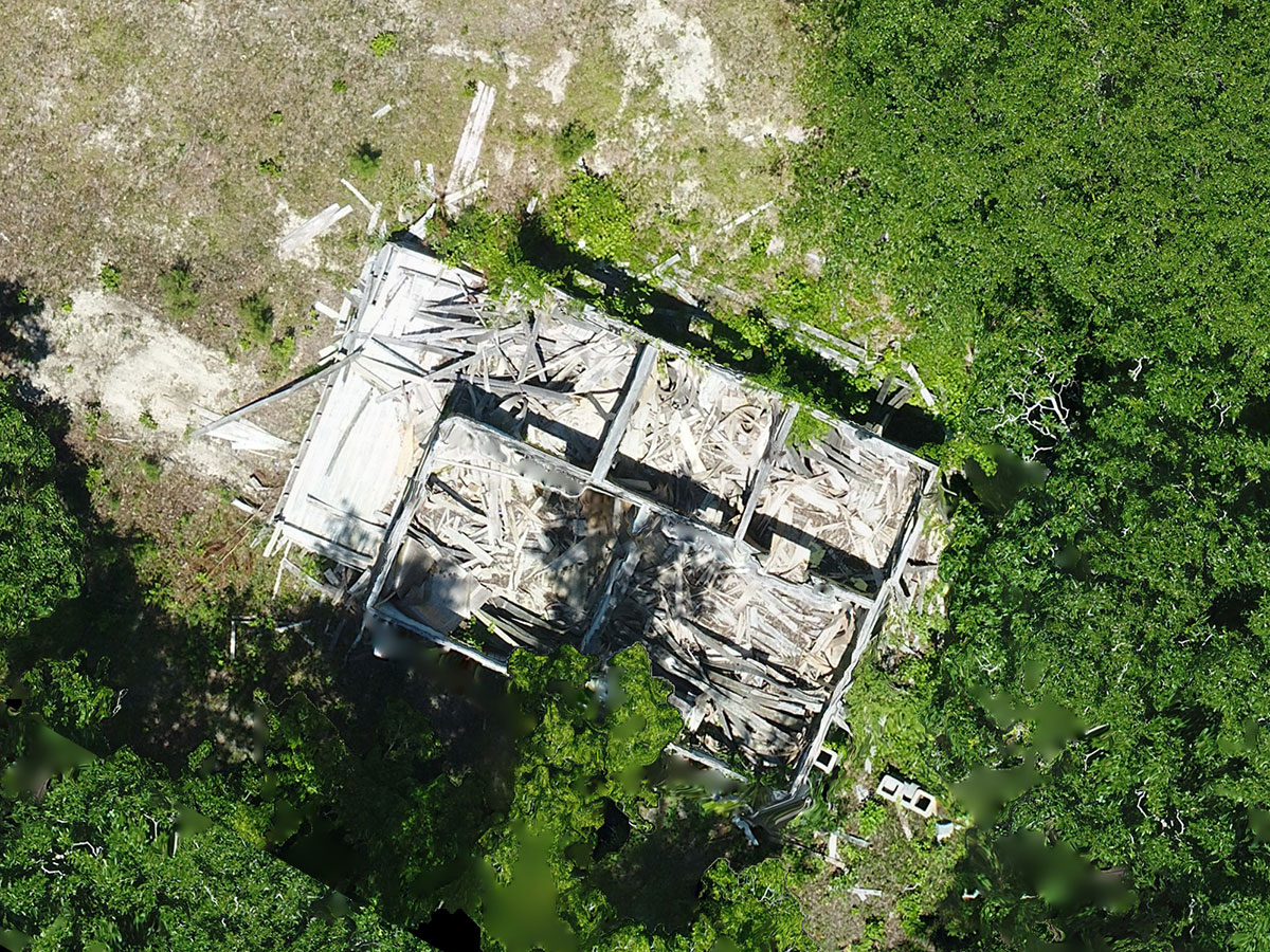
A three thousand-acre site can have a lot of hidden obstacles that might cost you big time. Drone imagery can resolve details as small as .5", enabling remote inspection of prospective site locations in ways that Google Earth can only dream of.
Accurately Evaluate Your Entire Site
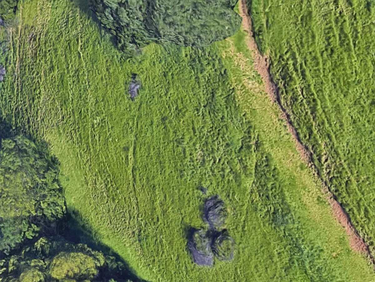
Google Earth Pro, or Google Maps, can easily lead an engineer to diagnose a tree as a rock-or vice versa. That ambiguity can lead to unanticipated costs during construction that necessitate an onsite visit.
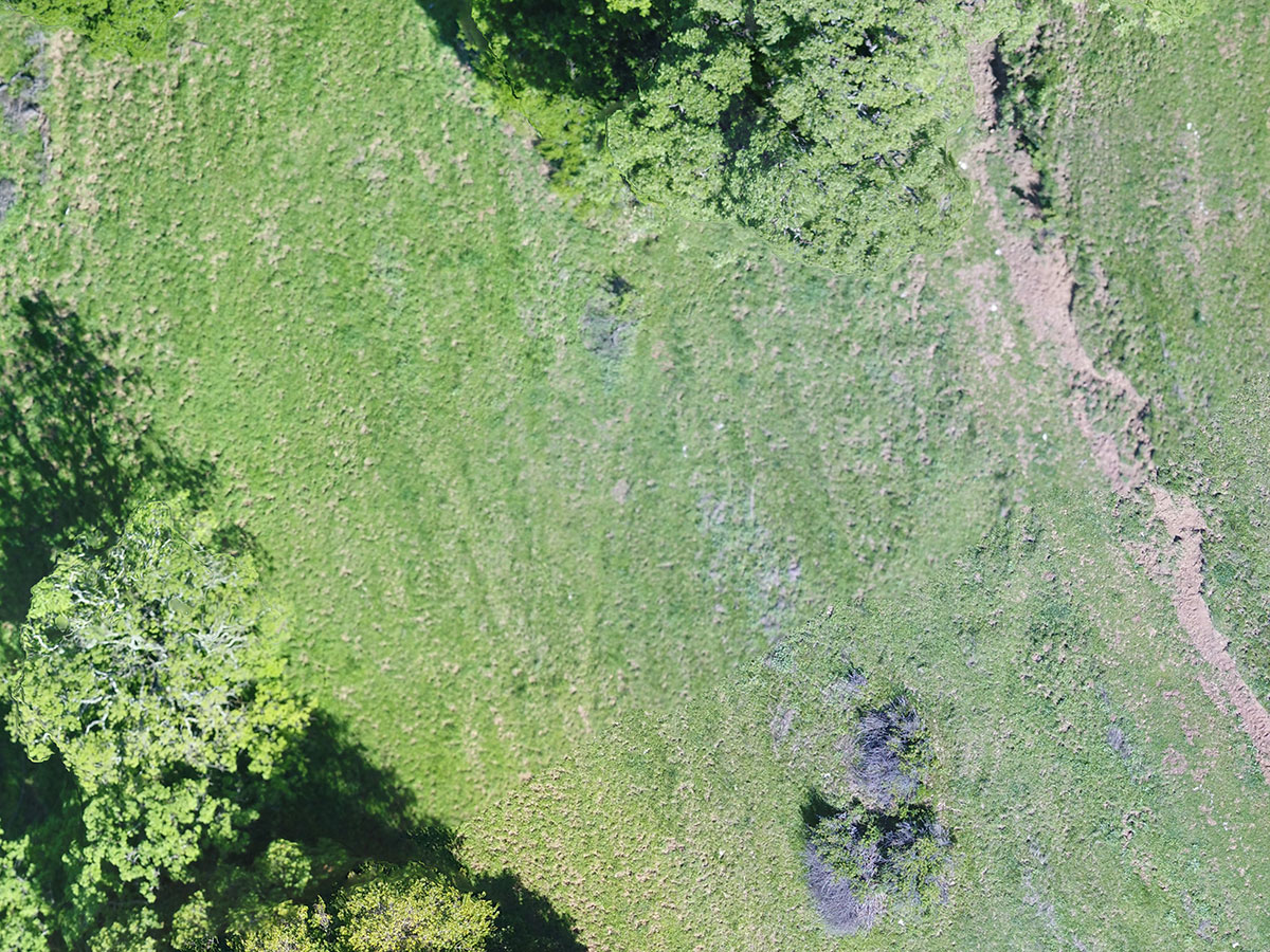
High-resolution orthomosaics generated by drones with high-speed cameras provide a clear indicator of the object-in this case a shrub.
Benefits & Features.
Easily identify problematic areas - remotely
Fast turnaround times, typically within 48 hours
Current, actionable information that reduces project costs
High resolution, as low as .5" GSD
Generate basic contours for overall topography
Optional Ground Control for higher accuracy
Why should I pick PXYZ?
Exclusively Focused on the Solar Industry
PXYZ was founded by experts in energy, aviation and technology. As experienced business people first, we understand the value of speed, accuracy and efficiency.
Secure Robotics
All of PXYZ's robotics are secure and approved for use at or near sensitive government airspace.
Superior Flight Operations
From military bases to active airfields and even prisons - if it can be flown legally we can get the clearance.
Fast Data Processing
PXYZ's software and engineers are able to turn over project deliverables with industry leading turnaround times.
Lower Costs, Better Data
Leveraging PXYZ's robotics and software drives down costs and manpower needs while increasing output data points.
Deep Financial Understanding
Only PXYZ provides a comprehensive financial analysis of your asset, ensuring you focus on the highest impact areas.
Precision XYZ Reviews

5 Star Reviews

Topographic Mapping
"Precision XYZ was able to deliver accurate topographic maps faster and more affordably than we have typically received on past projects. The engagement process was easy and the turnaround time was incredibly quick."
- Stephen Smith
Solvida Engineering

Topographic Mapping
"Project Gemini will be North America's largest solar power plant at just under 700MW of capacity. This project required both accuracy and speed, something that Precision XYZ executed perfectly. We would definitely recommend them to other developers."
- Ricardo Graf
Arevia Power

Progress Monitoring
"Precision XYZ has been very responsive. Their Site Progress Monitoring solution has been a big boon to getting a better handle on our projects. The visuals alone are very helpful, but with their metric driven system tied to daily financials it’s helped us directly manage our projects."
- Jeff Calabro
ArrayCon
*Actual customer testimonials. Photos are illustrative only.
Successful solar projects start here.
Get in touch with us now and find out how to really get your solar project off the ground.